 |
|
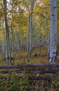
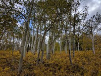
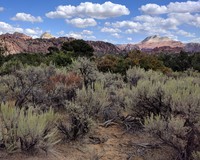
trees in sheep country north of Zion Park(jpg)
Google GeoTrack Maps Earth (.kmz) Nearby Pictures
Sat 09/28/19
 |
|
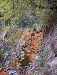
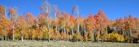
trees lake and grass in sheep country north of Zion Park(jpg)
Google GeoTrack Maps Earth (.kmz) Nearby Pictures
Sat 09/28/19
 |
|
horses in the fall near Kolob Reservoir(jpg)
Google GeoTrack Maps Earth (.kmz) Nearby Pictures
Sat 09/28/19
 |
|
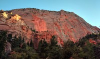
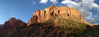
Kolob Canyon(jpg)
Google GeoTrack Maps Earth (.kmz) Nearby Pictures
Fri 09/27/19
 |
|
Kolob Canyon(jpg)
Google GeoTrack Maps Earth (.kmz) Nearby Pictures
Fri 09/27/19
 |
|
Kolob Canyon(jpg)
Google GeoTrack Maps Earth (.kmz) Nearby Pictures
Fri 09/27/19
 |
|
Kolob Canyon(jpg)
Google GeoTrack Maps Earth (.kmz) Nearby Pictures
Fri 09/27/19
 |
|
Kolob Canyon(jpg)
Google GeoTrack Maps Earth (.kmz) Nearby Pictures
Fri 09/27/19
 |
|
trees in sheep country north of Zion Park(jpg)
Google GeoTrack Maps Earth (.kmz) Nearby Pictures
Sat 09/28/19
 |
|
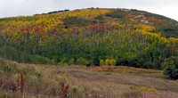
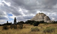
Pine Valley Peak(jpg)
Google GeoTrack Maps Earth (.kmz) Nearby Pictures
Sat 09/28/19
 |
|
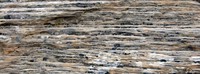
Pine Valley Peak wall pattern(jpg)
Google GeoTrack Maps Earth (.kmz) Nearby Pictures
Sat 09/28/19
 |
|
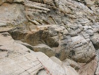
Pine Valley Peak wall(jpg)
Google GeoTrack Maps Earth (.kmz) Nearby Pictures
Sat 09/28/19
 |
|
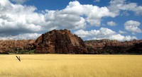
colors west of Zion NP(jpg)
Google GeoTrack Maps Earth (.kmz) Nearby Pictures
Sat 09/28/19
 |
|
bushes near Lambs Knoll(jpg)
Google GeoTrack Maps Earth (.kmz) Nearby Pictures
Sat 09/28/19
 |
|
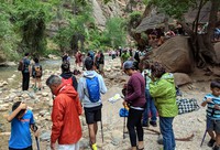
The Narrows Zion NP(jpg)
Google GeoTrack Maps Earth (.kmz) Nearby Pictures
Sat 09/28/19
 |
|
Virgin River Zion NP(jpg)
Google GeoTrack Maps Earth (.kmz) Nearby Pictures
Sat 09/28/19
 |
|
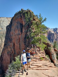
Angels Landing switchbacks(jpg)
Google GeoTrack Maps Earth (.kmz) Nearby Pictures
Sun 04/18/21
 |
|
seeing Angels Landing(jpg)
Google GeoTrack Maps Earth (.kmz) Nearby Pictures
Sun 04/18/21
 |
|
lower Angels Landing trail(jpg)
Google GeoTrack Maps Earth (.kmz) Nearby Pictures
Sun 04/18/21
 |
|
Alex on Angels Landing(jpg)
Google GeoTrack Maps Earth (.kmz) Nearby Pictures
Sun 04/18/21
 |
|
trees east of Cedar Breaks Nat Mon(jpg)
Google Maps Earth (.kmz) Nearby Pictures
Mon 09/30/19
 |
|
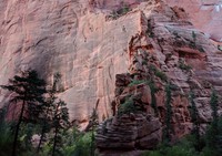
East Temple Zion NP(jpg)
Google GeoTrack Maps Earth (.kmz) Nearby Pictures
Sat 09/28/19
 |
|
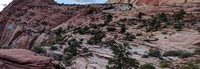
from Canyon Overlook Trail Zion NP(jpg)
Google GeoTrack Maps Earth (.kmz) Nearby Pictures
Sat 09/28/19
 |
|
eastern Zion(jpg)
Google GeoTrack Maps Earth (.kmz) Nearby Pictures
Sun 04/18/21
 |
|
this is real(jpg)
Google GeoTrack Maps Earth (.kmz) Nearby Pictures
Sun 04/18/21
 |
|
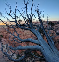
tree on rim trail Sunset Point Bryce Canyon(jpg)
Google GeoTrack Maps Earth (.kmz) Nearby Pictures
Mon 09/30/19
 |
|
from rim trail Sunset Point Bryce Canyon(jpg)
Google GeoTrack Maps Earth (.kmz) Nearby Pictures
Mon 09/30/19
 |
|
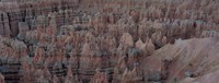
from Sunset Point in Bryce NP(jpg)
Google GeoTrack Maps Earth (.kmz) Nearby Pictures
Mon 09/30/19
 |
|
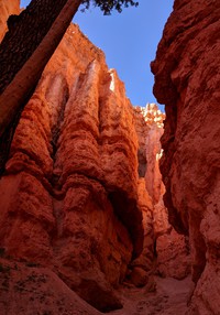
looking up Navaho Loop Trail Bryce Canyon(jpg)
Google GeoTrack Maps Earth (.kmz) Nearby Pictures
Tue 10/01/19
 |
|
looking down Navaho Loop Trail Bryce Canyon(jpg)
Google GeoTrack Maps Earth (.kmz) Nearby Pictures
Tue 10/01/19
 |
|
from Sunrise Point Bryce Canyon(jpg)
Google GeoTrack Maps Earth (.kmz) Nearby Pictures
Mon 09/30/19
 |
|
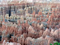
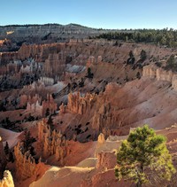
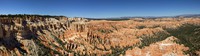
from Bryce Point(jpg)
Google GeoTrack Maps Earth (.kmz) Nearby Pictures
Tue 10/01/19
 |
|
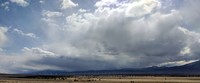
desert hills(jpg)
Google Maps Earth (.kmz) Nearby Pictures
Fri 04/16/21
 |
|
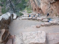
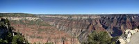
from Bright Angel Point on North Rim(jpg)
Google GeoTrack Maps Earth (.kmz) Nearby Pictures
Sun 09/29/19
 |
|
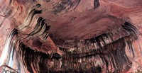
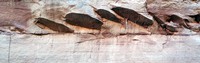
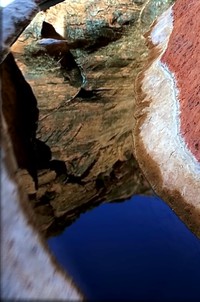
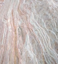
rock pattern(jpg)
Google GeoTrack Maps Earth (.kmz) Nearby Pictures
Sat 04/17/21
 |
|
Glen Canyon Dam power lines(jpg)
Google Maps Earth (.kmz) Nearby Pictures
Mon 04/19/21
 |
|
sprinklers near Cannonville Utah(jpg)
Google GeoTrack Maps Earth (.kmz) Nearby Pictures
Wed 10/02/19
 |
|
from Bryce Point(jpg)
Google GeoTrack Maps Earth (.kmz) Nearby Pictures
Tue 10/01/19
 |
|
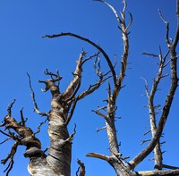
dead tree on Hells Backbone Road(jpg)
Google GeoTrack Maps Earth (.kmz) Nearby Pictures
Wed 10/02/19
 |
|
Long Canyon Buff Trail Road(jpg)
Google GeoTrack Maps Earth (.kmz) Nearby Pictures
Wed 10/02/19