 |
|
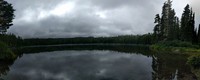
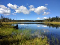
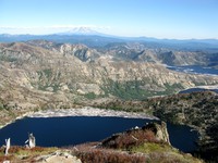
Takhlakh Lake(jpg)
Google GeoTrack Maps Earth (.kmz) Nearby Pictures
Fri 08/27/21
 |
|
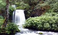
Twin Falls movie(jpg)
Google GeoTrack Maps Earth (.kmz) Nearby Pictures
Fri 08/27/21
 |
|
Twin Falls still(jpg)
Google GeoTrack Maps Earth (.kmz) Nearby Pictures
Fri 08/27/21
 |
|
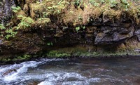
Lewis River side near Twin Falls(jpg)
Google GeoTrack Maps Earth (.kmz) Nearby Pictures
Fri 08/27/21
 |
|
August Mt Adams(jpg)
Google GeoTrack Maps Earth (.kmz) Nearby Pictures
Fri 08/27/21
 |
|
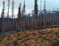
grass trees Mt Adams(jpg)
Google GeoTrack Maps Earth (.kmz) Nearby Pictures
Mon 09/19/16
 |
|
Steamboat Lake(jpg)
Google GeoTrack Maps Earth (.kmz) Nearby Pictures
Tue 09/20/16
 |
|
staying very still on the Indepence Pass trail(jpg)
Google GeoTrack Maps Earth (.kmz) Nearby Pictures
Sat 06/06/15
 |
|
Spirit Lake and St Helens from Independence Pass trail(jpg)
Google GeoTrack Maps Earth (.kmz) Nearby Pictures
Sat 06/06/15
 |
|
Mt St Helens from near WIndy Pass(jpg)
Google GeoTrack Maps Earth (.kmz) Nearby Pictures
Sun 08/21/11
 |
|
Spirit Lake log pattern(jpg)
Google GeoTrack Maps Earth (.kmz) Nearby Pictures
Sun 08/21/11
 |
|
Spirit Lake log pattern(jpg)
Google GeoTrack Maps Earth (.kmz) Nearby Pictures
Sun 08/21/11
 |
|
Spirit Lake log pattern(jpg)
Google GeoTrack Maps Earth (.kmz) Nearby Pictures
Sun 08/21/11
 |
|
Mt Log Rainier(jpg)
Google GeoTrack Maps Earth (.kmz) Nearby Pictures
Sun 08/21/11
 |
|
Mt Log St Helens(jpg)
Google GeoTrack Maps Earth (.kmz) Nearby Pictures
Sun 08/21/11
 |
|
Mt Log Adams(jpg)
Google GeoTrack Maps Earth (.kmz) Nearby Pictures
Sun 08/21/11
 |
|
Windy Pass stairs(jpg)
Google GeoTrack Maps Earth (.kmz) Nearby Pictures
Sun 08/21/11
 |
|
Windy Pass stairs(jpg)
Google GeoTrack Maps Earth (.kmz) Nearby Pictures
Sun 08/21/11
 |
|
Mt St Helens from near WIndy Pass(jpg)
Google GeoTrack Maps Earth (.kmz) Nearby Pictures
Sun 08/21/11
 |
|
Windy Pass(jpg)
Google GeoTrack Maps Earth (.kmz) Nearby Pictures
Sun 08/21/11
 |
|
this is not what it looks like(jpg)
Google GeoTrack Maps Earth (.kmz) Nearby Pictures
Tue 09/20/16
 |
|
Mt Adams and Spirit Lake from trail to Coldwater Peak(jpg)
Google GeoTrack Maps Earth (.kmz) Nearby Pictures
Thu 09/15/16
 |
|
Mt St Helens from trail to Coldwater Peak(jpg)
Google GeoTrack Maps Earth (.kmz) Nearby Pictures
Thu 09/15/16
 |
|
Spirit Lake from tail to Coldwater Peak(jpg)
Google GeoTrack Maps Earth (.kmz) Nearby Pictures
Thu 09/15/16
 |
|
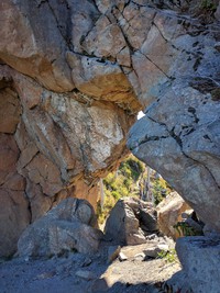
hole in the wall(jpg)
Google GeoTrack Maps Earth (.kmz) Nearby Pictures
Thu 09/15/16
 |
|
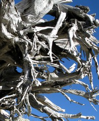
Mt St Helens tangle(jpg)
Google GeoTrack Maps Earth (.kmz) Nearby Pictures
Thu 09/15/16
 |
|
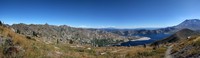
Mt Adams St Helens and Spirit Lakes(jpg)
Google GeoTrack Maps Earth (.kmz) Nearby Pictures
Thu 09/15/16
 |
|
Spirit Lake from Loowit Falls(jpg)
Google GeoTrack Maps Earth (.kmz) Nearby Pictures
Tue 09/20/16
 |
|
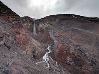
Loowit Falls(jpg)
Google GeoTrack Maps Earth (.kmz) Nearby Pictures
Tue 09/20/16
 |
|
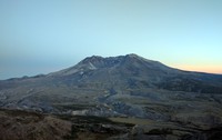
St Helens as the day goes down(jpg)
Google GeoTrack Maps Earth (.kmz) Nearby Pictures
Thu 09/15/16
 |
|
Mt Rainier under cloud(jpg)
Google GeoTrack Maps Earth (.kmz) Nearby Pictures
Sun 08/30/09
 |
|
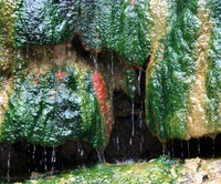
colorful warm water(jpg)
Google GeoTrack Maps Earth (.kmz) Nearby Pictures
Sun 06/01/08
 |
|
Starvation Creek parking lot from above(jpg)
Google GeoTrack Maps Earth (.kmz) Nearby Pictures
Sat 08/08/09
 |
|
No Top Mountain(jpg)
Google GeoTrack Maps Earth (.kmz) Nearby Pictures
Mon 06/19/23
 |
|
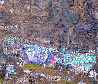
graffiti(jpg)
Google GeoTrack Maps Earth (.kmz) Nearby Pictures
Wed 04/07/21
 |
|
Vantage horses(jpg)
Google GeoTrack Maps Earth (.kmz) Nearby Pictures
Sat 04/26/08
 |
|
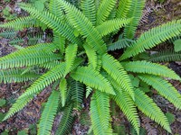
fern(jpg)
Google GeoTrack Maps Earth (.kmz) Nearby Pictures
Tue 07/25/17
 |
|
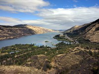
Rowena gorge from viewpoint(jpg)
Google GeoTrack Maps Earth (.kmz) Nearby Pictures
Sun 09/18/16
 |
|
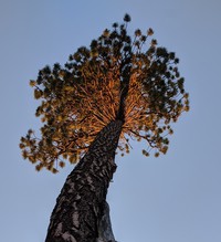
sunset pine(jpg)
Google GeoTrack Maps Earth (.kmz) Nearby Pictures
Sun 06/27/21
 |
|
bridge to the night(jpg)
Google GeoTrack Maps Earth (.kmz) Nearby Pictures
Sat 06/04/16