 |
|
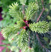
Owhigh Lake plant(jpg)
Google GeoTrack Maps Earth (.kmz) Nearby Pictures
Sun 07/13/14
 |
|
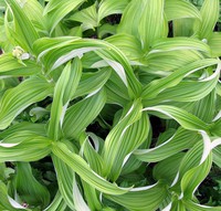
Owhigh Lake plant(jpg)
Google GeoTrack Maps Earth (.kmz) Nearby Pictures
Sun 07/13/14
 |
|
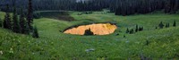
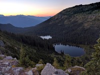
Little Owhigh Lake(jpg)
Google GeoTrack Maps Earth (.kmz) Nearby Pictures
Sun 08/13/23
 |
|
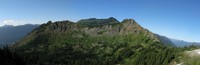
Governors Ridge behind Owhigh Lake(jpg)
Google GeoTrack Maps Earth (.kmz) Nearby Pictures
Sun 08/13/23
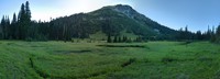
Owhigh Lakes pano(jpg)
Google GeoTrack Maps Earth (.kmz) Nearby Pictures
Sun 07/13/14
Owhigh Lake reeds(jpg)
Google GeoTrack Maps Earth (.kmz) Nearby Pictures
Sun 08/13/23
 |
|
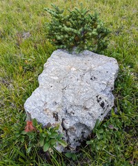
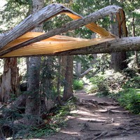
rock tree and green(jpg)
Google GeoTrack Maps Earth (.kmz) Nearby Pictures
Sun 08/13/23
 |
|
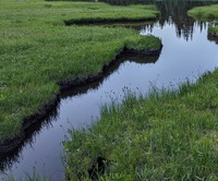
Owhigh Lake arm(jpg)
Google GeoTrack Maps Earth (.kmz) Nearby Pictures
Sun 08/13/23
 |
|
Tamanos Mountain(jpg)
Google GeoTrack Maps Earth (.kmz) Nearby Pictures
Sun 08/13/23
 |
|
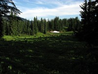
In A Glade(jpg)
Google GeoTrack Maps Earth (.kmz) Nearby Pictures
Sun 08/13/23
 |
|
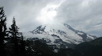
Mt Rainier from Tamanos Mountain(jpg)
Google GeoTrack Maps Earth (.kmz) Nearby Pictures
Sun 07/13/14
 |
|
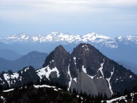
mountains behind Double Peak(jpg)
Google GeoTrack Maps Earth (.kmz) Nearby Pictures
Sun 07/13/14
 |
|
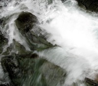
Wright Creek(jpg)
Google GeoTrack Maps Earth (.kmz) Nearby Pictures
Sun 07/13/14
 |
|
Wright Creek(jpg)
Google GeoTrack Maps Earth (.kmz) Nearby Pictures
Sun 07/13/14
 |
|
Governors Ridge(jpg)
Google GeoTrack Maps Earth (.kmz) Nearby Pictures
Sun 08/13/23
 |
|
rock pattern(jpg)
Google GeoTrack Maps Earth (.kmz) Nearby Pictures
Sun 08/13/23
 |
|
Frying Pan Creek in August(jpg)
Google GeoTrack Maps Earth (.kmz) Nearby Pictures
Sat 08/25/12
 |
|
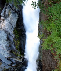
Frying Pan Creek thru the shute(jpg)
Google GeoTrack Maps Earth (.kmz) Nearby Pictures
Sat 08/25/12
 |
|
Rainier sun sky(jpg)
Google GeoTrack Maps Earth (.kmz) Nearby Pictures
Sun 08/05/12
 |
|
meadow above Cayuse Pass(jpg)
Google GeoTrack Maps Earth (.kmz) Nearby Pictures
Sun 08/05/12
 |
|
Chinook Pass pana(jpg)
Google GeoTrack Maps Earth (.kmz) Nearby Pictures
Sun 08/05/12
 |
|
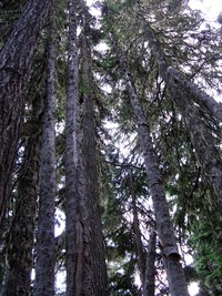
Cayuse Pass trees(jpg)
Google GeoTrack Maps Earth (.kmz) Nearby Pictures
Sun 08/05/12
 |
|
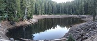
lake above Cayuse Pass(jpg)
Google GeoTrack Maps Earth (.kmz) Nearby Pictures
Sun 08/05/12
 |
|
Ghost Lake in September(jpg)
Google GeoTrack Maps Earth (.kmz) Nearby Pictures
Mon 09/11/17
 |
|
Frying Pan Creek Summerland trail(jpg)
Google GeoTrack Maps Earth (.kmz) Nearby Pictures
Sat 08/25/12
 |
|
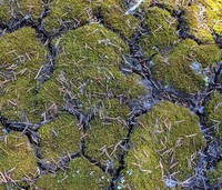
mossy pattern(jpg)
Google GeoTrack Maps Earth (.kmz) Nearby Pictures
Mon 09/06/21
 |
|
mossy pattern(jpg)
Google GeoTrack Maps Earth (.kmz) Nearby Pictures
Mon 09/06/21
 |
|
creek along Owyhigh Trail(jpg)
Google GeoTrack Maps Earth (.kmz) Nearby Pictures
Sun 07/13/14
 |
|
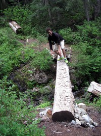
Charlie on a twister log(jpg)
Google GeoTrack Maps Earth (.kmz) Nearby Pictures
Sun 08/25/13
 |
|
Cayuse Pass equipment(jpg)
Google GeoTrack Maps Earth (.kmz) Nearby Pictures
Sun 08/05/12
 |
|
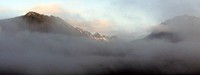
misty mountains(jpg)
Google GeoTrack Maps Earth (.kmz) Nearby Pictures
Sat 08/13/11
 |
|
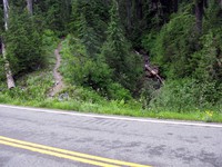
where east side trail crosses the road(jpg)
Google GeoTrack Maps Earth (.kmz) Nearby Pictures
Sun 08/05/12
 |
|
Cowlitz Divide trail(jpg)
Google GeoTrack Maps Earth (.kmz) Nearby Pictures
Sun 07/27/14
 |
|
white river(jpg)
Google GeoTrack Maps Earth (.kmz) Nearby Pictures
Sun 05/17/09
 |
|
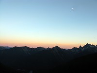
moon over the Cascades(jpg)
Google GeoTrack Maps Earth (.kmz) Nearby Pictures
Tue 09/22/15
 |
|
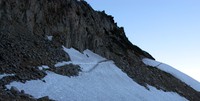
last bit of trail to Frying Pan Gap(jpg)
Google GeoTrack Maps Earth (.kmz) Nearby Pictures
Sat 08/25/12
 |
|
Deadwood Lakes(jpg)
Google GeoTrack Maps Earth (.kmz) Nearby Pictures
Tue 08/16/16
 |
|
from below yakima peak(jpg)
Google GeoTrack Maps Earth (.kmz) Nearby Pictures
Sat 07/27/13
 |
|
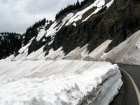
chinook pass road(jpg)
Google GeoTrack Maps Earth (.kmz) Nearby Pictures
Mon 05/17/10
 |
|
Summerland trail wildflowers(jpg)
Google GeoTrack Maps Earth (.kmz) Nearby Pictures
Sat 08/25/12