 |
|
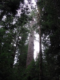
Cowlitz Divide trail Olallie Creek camp sign(jpg)
Google GeoTrack Maps Earth (.kmz) Nearby Pictures
Sat 06/15/13
 |
|
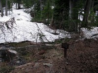
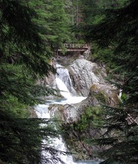
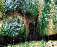
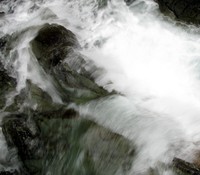
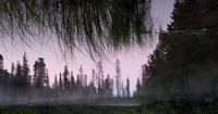
Cowlitz Divide trail Olallie Creek waterfall(jpg)
Google GeoTrack Maps Earth (.kmz) Nearby Pictures
Sat 06/15/13
 |
|
Mount Adams from Cowlitz Divide(jpg)
Google GeoTrack Maps Earth (.kmz) Nearby Pictures
Sun 07/27/14
 |
|
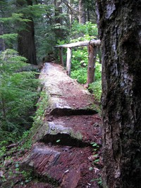
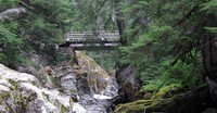
Cowlitz Divide trail log bridge(jpg)
Google GeoTrack Maps Earth (.kmz) Nearby Pictures
Sat 06/15/13
 |
|
Mount Rainier from Cowlitz Divide(jpg)
Google GeoTrack Maps Earth (.kmz) Nearby Pictures
Sun 07/27/14
 |
|
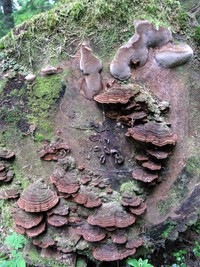
Cowlitz Divide trail fungus(jpg)
Google GeoTrack Maps Earth (.kmz) Nearby Pictures
Sat 06/15/13
 |
|
Cowlitz Divide trail(jpg)
Google GeoTrack Maps Earth (.kmz) Nearby Pictures
Sun 07/27/14
 |
|
Cowlitz Divide Trailhead(jpg)
Google GeoTrack Maps Earth (.kmz) Nearby Pictures
Sat 06/15/13
 |
|
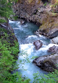
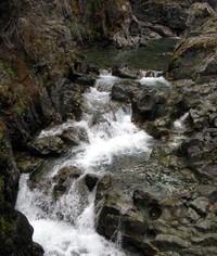
Ohanapecosh River(jpg)
Google GeoTrack Maps Earth (.kmz) Nearby Pictures
Sat 06/21/14
 |
|
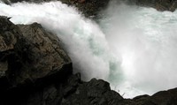
Silver Falls(jpg)
Google GeoTrack Maps Earth (.kmz) Nearby Pictures
Sat 06/21/14
 |
|
Silver Falls(jpg)
Google GeoTrack Maps Earth (.kmz) Nearby Pictures
Sat 06/21/14
 |
|
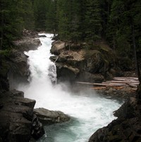
Upper Silver Falls(jpg)
YouTube Video http://www.youtube.com/watch?v=47e8FrlVW2s
Google GeoTrack Maps Earth (.kmz) Nearby Pictures
Sun 06/01/08
 |
|
Laughingwater Falls(jpg)
Google GeoTrack Maps Earth (.kmz) Nearby Pictures
Sat 06/21/14
 |
|
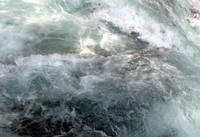
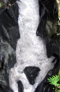
water pattern(jpg)
Google GeoTrack Maps Earth (.kmz) Nearby Pictures
Sun 06/01/08
 |
|
Silver Falls(jpg)
Google GeoTrack Maps Earth (.kmz) Nearby Pictures
Sun 06/01/08
 |
|
Eastside Trail trees(jpg)
Google GeoTrack Maps Earth (.kmz) Nearby Pictures
Sun 08/25/13
 |
|
Eastside Trail best bridge and falls(jpg)
Google GeoTrack Maps Earth (.kmz) Nearby Pictures
Sun 08/25/13
 |
|
Box Canyon ground(jpg)
Google GeoTrack Maps Earth (.kmz) Nearby Pictures
Sun 07/27/14
 |
|
Box Canyon from above(jpg)
Google GeoTrack Maps Earth (.kmz) Nearby Pictures
Sun 07/27/14
 |
|
bridge to the night(jpg)
Google GeoTrack Maps Earth (.kmz) Nearby Pictures
Sat 06/04/16
 |
|
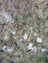
warm water grass(jpg)
Google GeoTrack Maps Earth (.kmz) Nearby Pictures
Sun 06/01/08
 |
|
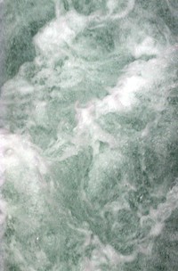
colorful warm water(jpg)
Google GeoTrack Maps Earth (.kmz) Nearby Pictures
Sun 06/01/08
Mt Rainier from Shriner Peak(jpg)
Google GeoTrack Maps Earth (.kmz) Nearby Pictures
Sat 08/01/09
 |
|
Eastside Trail bridge(jpg)
Google GeoTrack Maps Earth (.kmz) Nearby Pictures
Sun 08/25/13
 |
|
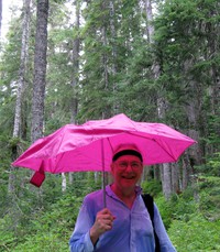
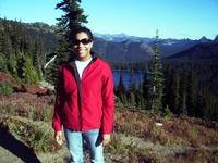
Charlie spotting game(jpg)
Google GeoTrack Maps Earth (.kmz) Nearby Pictures
Sun 08/25/13
 |
|
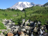
Stafford Falls(jpg)
Google GeoTrack Maps Earth (.kmz) Nearby Pictures
Sun 08/25/13
 |
|
Mt Rainier under cloud(jpg)
Google GeoTrack Maps Earth (.kmz) Nearby Pictures
Sun 08/30/09
 |
|
Eastside Trail falls(jpg)
Google GeoTrack Maps Earth (.kmz) Nearby Pictures
Sat 06/21/14
 |
|
Alex roughing it on the Eastside Trail(jpg)
Google GeoTrack Maps Earth (.kmz) Nearby Pictures
Sun 08/25/13
 |
|
creek along Owyhigh Trail(jpg)
Google GeoTrack Maps Earth (.kmz) Nearby Pictures
Sun 07/13/14
 |
|
a waterfall on Stevens Creek trail(jpg)
Google GeoTrack Maps Earth (.kmz) Nearby Pictures
Wed 07/20/16
 |
|
from the depths of Stevens Creek Canyon(jpg)
Google GeoTrack Maps Earth (.kmz) Nearby Pictures
Wed 07/20/16
 |
|
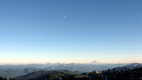
Mt Adams and moon from Frying Pan Gap(jpg)
Google GeoTrack Maps Earth (.kmz) Nearby Pictures
Sat 08/25/12
 |
|
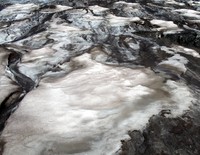
Mt Rainier snow pattern(jpg)
Google GeoTrack Maps Earth (.kmz) Nearby Pictures
Sun 08/30/09
 |
|
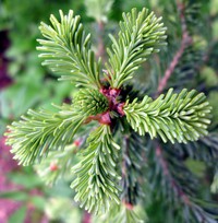
Owhigh Lake plant(jpg)
Google GeoTrack Maps Earth (.kmz) Nearby Pictures
Sun 07/13/14
 |
|
Bench Lake(jpg)
Google GeoTrack Maps Earth (.kmz) Nearby Pictures
Tue 07/26/16
 |
|
Heather in front of Dewey Lake(jpg)
Google GeoTrack Maps Earth (.kmz) Nearby Pictures
Fri 09/21/07
 |
|
Mt Rainier from above Paradise(jpg)
Google GeoTrack Maps Earth (.kmz) Nearby Pictures
Sun 08/30/09
 |
|
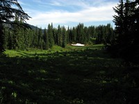
meadow above Cayuse Pass(jpg)
Google GeoTrack Maps Earth (.kmz) Nearby Pictures
Sun 08/05/12
 |
|
Mt Rainier under cloud(jpg)
Google GeoTrack Maps Earth (.kmz) Nearby Pictures
Sun 08/30/09