 |
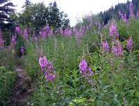
|
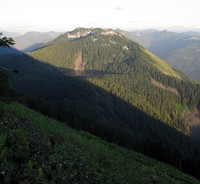
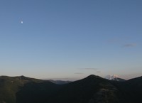
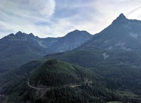
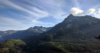
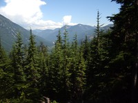
Bandara Mountain and Mason Lake from Mt Defiance(jpg)
Google GeoTrack Maps Earth (.kmz) Nearby Pictures
Sat 07/10/10
 |
|
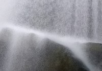
waterfall video(jpg)
Google GeoTrack Maps Earth (.kmz) Nearby Pictures
Sat 05/15/21
 |
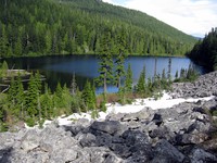
|
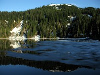
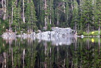
Mason Lake(jpg)
Google GeoTrack Maps Earth (.kmz) Nearby Pictures
Sun 07/10/11
 |
|
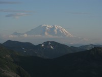
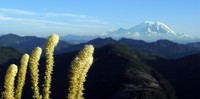
floating Mt Rainier(jpg)
Google GeoTrack Maps Earth (.kmz) Nearby Pictures
Sun 07/10/11
 |
|
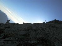
Brad not Steve coming down off Stinky Petes Peak(jpg)
Google GeoTrack Maps Earth (.kmz) Nearby Pictures
Sat 07/10/10
 |
|
Mason Lake(jpg)
Google GeoTrack Maps Earth (.kmz) Nearby Pictures
Sat 07/10/10
 |
|
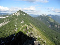
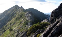
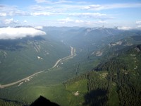
Mt Defiance and Bandara Mountain or The way back to the car(jpg)
Google GeoTrack Maps Earth (.kmz) Nearby Pictures
Sat 07/10/10
 |
|
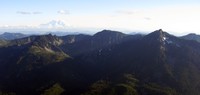
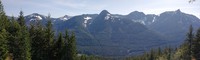
Mt Rainier and McClellan Butte from Stinky Petes Peak(jpg)
Google GeoTrack Maps Earth (.kmz) Nearby Pictures
Sat 07/10/10
 |
|
looking west from Stinky Petes Peak(jpg)
Google GeoTrack Maps Earth (.kmz) Nearby Pictures
Sat 07/10/10
 |
|
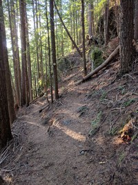
hills south of I90 from Ira Springs Trail(jpg)
Google GeoTrack Maps Earth (.kmz) Nearby Pictures
Sat 05/15/21
 |
|
Mt Rainier from Bandera Mountain(jpg)
Google GeoTrack Maps Earth (.kmz) Nearby Pictures
Sun 07/25/10
 |
|
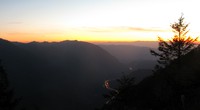
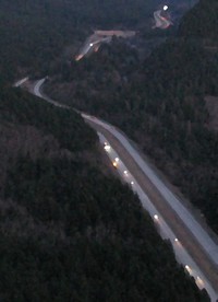
I90 sunset from Mason Lake Trail(jpg)
Google GeoTrack Maps Earth (.kmz) Nearby Pictures
Sat 07/10/10
 |
|
Mt Moondier(jpg)
Google GeoTrack Maps Earth (.kmz) Nearby Pictures
Sun 07/10/11
 |
|
Putrid Pete Dirty Harry trail junction(jpg)
Google GeoTrack Maps Earth (.kmz) Nearby Pictures
Wed 08/30/17
 |
|
i see the problem right here(jpg)
Google GeoTrack Maps Earth (.kmz) Nearby Pictures
Sun 05/01/11
 |
|
lets see clint eastwood get out of this one(jpg)
Google GeoTrack Maps Earth (.kmz) Nearby Pictures
Sun 05/01/11
 |
|
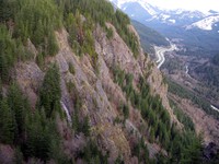
McClellan Butte and more from off trail ledge(jpg)
Google GeoTrack Maps Earth (.kmz) Nearby Pictures
Wed 08/30/17
 |
|
conduit over river(jpg)
Google GeoTrack Maps Earth (.kmz) Nearby Pictures
Sun 05/01/11
 |
|
Dirty Harrys Balcony waterfall(jpg)
Google GeoTrack Maps Earth (.kmz) Nearby Pictures
Wed 05/04/11
 |
|
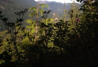
soft trees(jpg)
Google GeoTrack Maps Earth (.kmz) Nearby Pictures
Sat 05/02/09
 |
|
from dirty harrys balcony in the rain(jpg)
Google GeoTrack Maps Earth (.kmz) Nearby Pictures
Sat 05/02/09
 |
|
Talapus Lake from Pratt Mountain trail(jpg)
Google GeoTrack Maps Earth (.kmz) Nearby Pictures
Sun 09/20/09
 |
|
McClellan Butte from near Dirty Harrys Ledge(jpg)
Google GeoTrack Maps Earth (.kmz) Nearby Pictures
Wed 08/30/17
 |
|
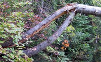
tree on Pratt Mountain trail(jpg)
Google GeoTrack Maps Earth (.kmz) Nearby Pictures
Sun 09/20/09
 |
|
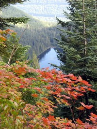
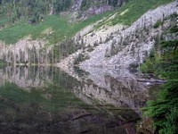
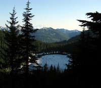
Granite Lake(jpg)
Google GeoTrack Maps Earth (.kmz) Nearby Pictures
Sun 08/16/09
 |
|
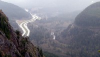
I90 from Dirty Harrys Balcony(jpg)
Google GeoTrack Maps Earth (.kmz) Nearby Pictures
Fri 03/20/20
 |
|
from a ledge over the freeway(jpg)
Google GeoTrack Maps Earth (.kmz) Nearby Pictures
Sat 09/13/14
 |
|
Granite Lake(jpg)
Google GeoTrack Maps Earth (.kmz) Nearby Pictures
Sun 08/16/09
 |
|
Granite Lake(jpg)
Google GeoTrack Maps Earth (.kmz) Nearby Pictures
Sun 08/16/09
 |
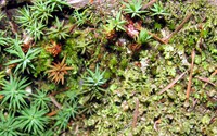
|
Granite Lake flowers(jpg)
Google GeoTrack Maps Earth (.kmz) Nearby Pictures
Sun 08/16/09
 |
|
Talapus Lake(jpg)
Google GeoTrack Maps Earth (.kmz) Nearby Pictures
Sun 07/10/11
 |
|
Dirty Harrys mini world(jpg)
Google GeoTrack Maps Earth (.kmz) Nearby Pictures
Sat 09/13/14
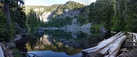 |
|
Rainy Lake(jpg)
Google GeoTrack Maps Earth (.kmz) Nearby Pictures
Sat 07/14/18
 |
|
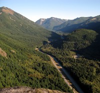
I90 from McClellan Butte trail(jpg)
Google GeoTrack Maps Earth (.kmz) Nearby Pictures
Sun 08/05/07
 |
|
up some hill south of i90(jpg)
Google GeoTrack Maps Earth (.kmz) Nearby Pictures
Sat 07/28/07
 |
|
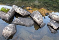
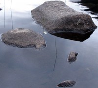
Pratt Lake rocks(jpg)
Google GeoTrack Maps Earth (.kmz) Nearby Pictures
Thu 07/16/20
 |
|
I say James do drive on(jpg)
Google GeoTrack Maps Earth (.kmz) Nearby Pictures
Wed 07/29/09
 |
|
I90 from McClellan Butte trail(jpg)
Google GeoTrack Maps Earth (.kmz) Nearby Pictures
Sun 08/05/07
 |
|
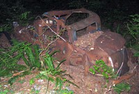
me mantus food(jpg)
Google GeoTrack Maps Earth (.kmz) Nearby Pictures
Sun 05/01/11
 |
|
Olallie Lake(jpg)
Google GeoTrack Maps Earth (.kmz) Nearby Pictures
Fri 07/01/11